9/8/2013 12:52:40 PM
62°36'55.38" N 141°0'6.2" W Map
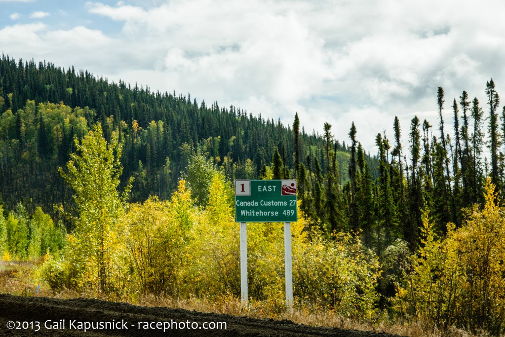
Entering Canada. I was surprised to find that Customs & Immigration was another 15 mi down the road.

9/8/2013 12:52:45 PM
62°36'52.8" N 141°0'1.03" W Map
Sigh......this was a buzzkill...we arrived at this sign and had to stop & sit. Would this work in the USA? I wonder how many dim bulbs blow right by this.... I've heard the Mounties don't have a real sense of humor so we weren't about to try it.

9/8/2013 12:54:17 PM
62°36'27.61" N 140°58'42.83" W Map
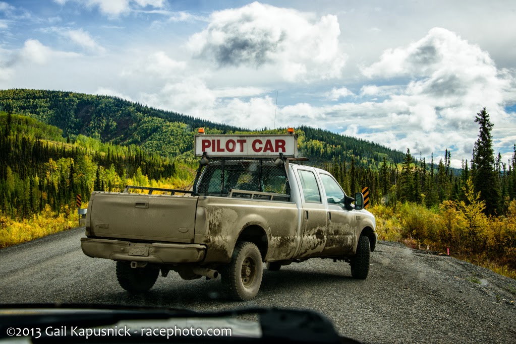
The pilot car(truck) showed up finally. It was pretty grungy from all the dust!
9/8/2013 1:05:00 PM
62°36'27.19" N 140°58'41.68" W Map
Nice that they let you know you have 27km to ditch all that stuff you forgot couldn't go through Canada :-)
9/8/2013 1:05:53 PM
62°36'18.55" N 140°58'22.09" W Map
Creeping along behind the pilot car allowed time to enjoy the scenery.

9/8/2013 1:40:27 PM
Traffic was backed up pretty badly. We spent 45 minutes creeping along behind the pace car.

9/8/2013 1:43:12 PM
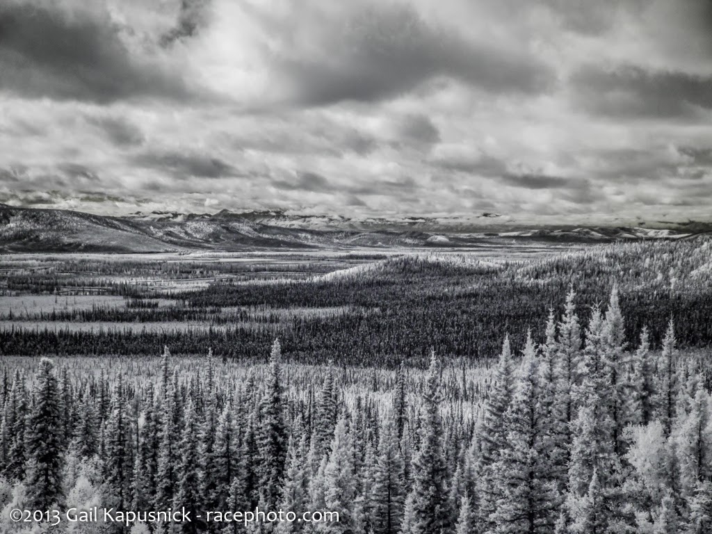
62°28'44.76" N 140°51'53.58" W Map
Another infrared shot

9/8/2013 12:57:42 PM

9/8/2013 12:58:21 PM
I have to remember to stop here next time. Looked nice. It was just south of the C&I station and across from where we got gas, but we had lost enough time that we didn't wanna spend any more sightseeing.

9/8/2013 1:57:16 PM
62°22'55.68" N 140°52'30.67" W Map

Quothe the Raven, "Are you kidding me???"

9/8/2013 2:02:44 PM
62°22'55.32" N 140°52'29.69" W Map
The weather and road took a turn for the better.

9/8/2013 2:09:30 PM
62°21'31.67" N 140°51'36.67" W Map

9/8/2013 2:22:56 PM
62°13'7.46" N 140°41'33.69" W Map

9/8/2013 2:26:33 PM
62°10'33.07" N 140°40'28.09" W Map
The White River.

9/8/2013 2:43:05 PM
61°59'30.73" N 140°33'58.68" W Map
Mark waiting (sorta) patiently

9/8/2013 2:43:29 PM
61°59'30.73" N 140°33'59.07" W Map
Crossing the White River

9/8/2013 2:44:49 PM
61°59'16.62" N 140°33'24.71" W Map

9/8/2013 2:49:20 PM
61°57'54.18" N 140°25'44.03" W Map
A friend of mine referred to this drive as a "moving postcard". He was right.

9/8/2013 2:52:51 PM
61°56'11.86" N 140°20'51.92" W Map

9/8/2013 3:01:04 PM
61°51'42.97" N 140°9'20.35" W Map

9/8/2013 3:10:35 PM
61°45'47.18" N 139°57'26.5" W Map
Crossing the Donjek River

9/8/2013 3:20:38 PM
61°40'44.68" N 139°45'10.28" W Map

9/8/2013 3:58:03 PM

9/8/2013 5:08:50 PM
60°52'5.87" N 137°48'14.8" W Map
The fall colors hadn't gotte this far south.

9/8/2013 5:19:05 PM
60°45'59.78" N 137°33'53.98" W Map

9/8/2013 5:36:23 PM
It was windy....dust from the construction got pretty annoying.

9/8/2013 6:07:10 PM
Blowing dust

9/8/2013 6:07:13 PM
60°48'30.2" N 136°31'40.28" W Map
Ahhhh...much better!!!

9/8/2013 6:28:08 PM
60°50'9.98" N 135°54'5.62" W Map
We got to Whitehorse amd tried to check in to the Best Western Gold Rush Inn. Until we found out they only had single twin bed rooms left, at $190 per night!!! No thank you! The place next door was $119 and that's where we went. It was a decent room with fridge & microwave, but the wifi didn't reach that far. :-( By the time we got checked in and whatnot it was fairly late.
We had heard a lot about the Rib & Salmon and walked over there hoping it was open. It was.


We headed back to the room and crashed. It had been a long day.